GPS data on M2M Modules
Device manufacturers implement proprietary AT coommand interfaces for GPS functions. General controls are enable/disable GPS, set GPS mode (standalone, MS-Assisted etc) and get GPS data.
GPS Testing for Huawei Modules
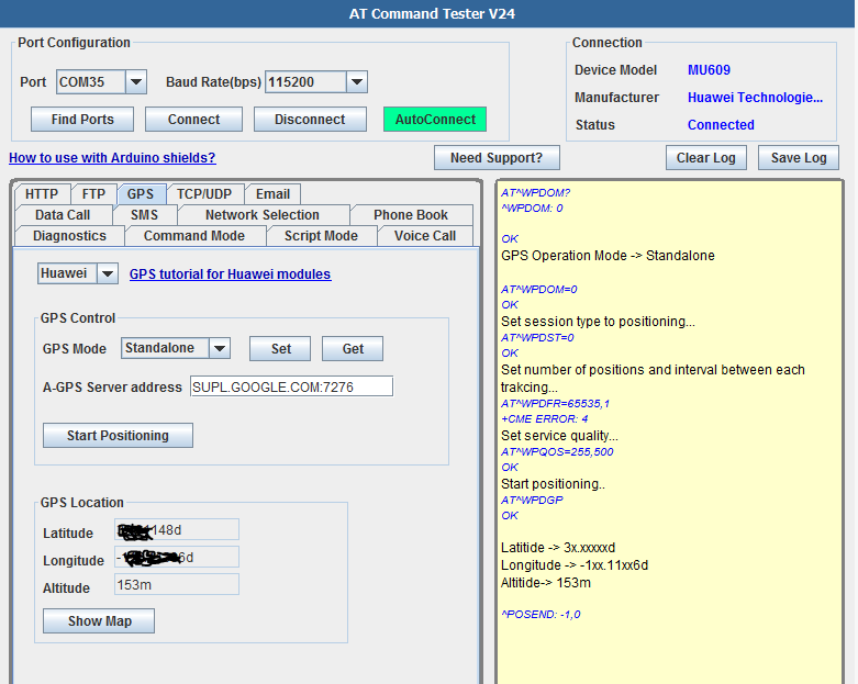
In the ‘GPS’ tab of AT Command Tester, the GPS feature of Huawei modules can be tested.
Huawei modules supports different kind of GPS modes such as standlone, MS-Assisted, MS-based and gpsOneXTRA. Use can set the specific mode. Once the ‘Start Positioning’ button is presssed, the module will acquire the GPS position. Based the the GPS mode configured, the acquisition could vary and could take up to a minute. Once the GPS position is available, GPS information (latitude, longitude, altitude) will be automatically populated in the corresponding fields. If the GPS information is available, the ‘Show Map’ button will open the Google maps in a browser with the avaialble GPS coordinates.
Set session type to positioning...

AT^WPDST=0
OK
Set number of positions and interval between each trakcing…
AT^WPDFR=65535,1
+CME ERROR: operation not supported
Set service quality…
AT^WPQOS=255,500
OK
Start positioning..
AT^WPDGP
OK
^POSITION: -1xx.xxxxxxd,3x.xxxxxxd,170m
Latitide -> 3x.xxxxxxd
Longitude -> -1xx.xxxxxxd
Altitide-> 170m
^POSEND: -1,0
Keywords: Module , M2M , GPRS , 3G , through AT commands,